The River Nile
Facts About The River Nile
From south to north, the Nile River which is the most extended river globally runs through African lands separating Egypt into multiple divisions that eventually flow into The Mediterranean Sea via two channels; Rosetta Branch and Damietta Branch respectively. Its total length from its sources in Lake Tanganyika up to its estuary found within Meditterranean sea covers about 6650 km while having a catchment area of 1.9 million square kilometers over 11 different nations including Tanzania - Kenya - Zaire - Burundi – Rwanda – Ethiopia - Eritrea - Uganda – South Sudan - Egypt.
The Nile River originates from Lake Victoria and is interrupted by falls and cliffs that it overcomes to rush strongly up or down until it reaches its natural course. According to the Greek historian Herodotus, "the Nile is the giver of Egypt." One form of tourism, known as "Nile tourism," is centered around the Nile River and involves boats transporting guests to Egypt from the north and south. The river's importance in Egyptian culture is the reason behind this.
The White Nile from Lake Victoria Plateau and the Blue Nile from Lake Tana in Ethiopia are the two primary tributaries that make up the Nile River. This data has been revised. In this instance, the two major tributaries that make up the entire Nile River come together. The location is in Khartoum, the capital of Sudan.
Nile valley Historical overview The Nile has always been the center of immense strength and therefore the object of wishes of colonialists in the 19th Century. It was the period when the European nations had dominion over the Nile Basin countries, when Britain was the Chuuka, including Egypt, Sudan, Uganda and Kenya, Germany ruled Tanzania, Rwanda and Burundi while the Democratic Republic of Congo was ruled by Belgian colonialists known previously as Zaire.
With the conclusion of World war 1,1914-1918 the German empire was partitioned between the British and the Belgians. The British Empire took over Tanzania while the Belgian Empire took control of Rwanda and Burundi — that’s a colonialism history in brief and Ethiopia, remained free. And with the call of the British occupation of Egypt & Sudan in the 1950s, came the Nile River Treaty allocating shares of water in 1959.
Disregarding its claim to being the longest river in the world, the Nile epitomizes all that is Egypt in terms of geography, history, and culture. The Nile is located in the northeastern region of Africa and is about 6,650 kilometers long (4,130 miles), running through 11 different countries before emptying into the Mediterranean Sea. Nevertheless, the most well-known portion of the river is certainly in the country of Egypt, where not only has the river formed the present-day geography of the place but also sustained one of the most ancient and greatest civilizations in the world. It is often referred to as the ‘Gift of the Nile’. Most of the wealth, progress, and history of Egypt have revolved around this river.
Egypt boasts of long stretches of deserts, but it is interesting to note that the Nile River has succeeded in forming a vegetative zone in the region otherwise characterized by dry lands. Without the Nile River, the majority of regions within this nation’s borders would more likely than not be empty and unproductive land. It supplies water, which is sourced for farming, business, and even household use. In ancient times, the Nile used to spill over its banks, and every year the lands along the river, such as the region around the Nile, received rich alluvial deposits that were excellent for farming. These floodwaters every year without fail were perfect for growing crops for the ancient Egyptians, who grew different crops such as wheat, barley, and flax, which were the main food and agricultural income of this community.
Today, while the Aswan Dam was built in 1970, which led to the complete control of tree flooding and therefore the abolition of the age-old flood regime, the Nile River is still of great importance for agriculture in Egypt. Filmy green container siding strips that fit perfectly along the banks of the river, which is reminiscent of the shape of the river, sharply contrast with the yellow sand canvas of the desert, indicating that the Nile River is of key importance to the people of Egypt.
The Nile was an important resource for agriculture, but its relevance does not end there; much of today’s world owes its existence to Egypt as we know it. Civilizations flourished on both banks of the ancient Nile as it provided not just water and rich alluvial plains, but also integrated the two banks using transport and communication. The river was crisscrossed by boats transporting goods, people, and ideas, effectively bridging the gap between Upper and Lower Egypt and emerging as one of the most powerful kingdoms.
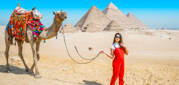
Furthermore, the river found its place also in the divine and cultural aspects of the ancient Egyptians. The floods of the river, which were very important for agriculture, were treated in ancient times as a curse from Hapi, the protective god of the fertile Delta and the Nile. The river was also linked with the idea of death and what came after it. The Egyptians believed that the east side of the Nile River where the sun rose was the region of the living, while the west side where sunset occurred was the realm of the dead. This explains why some of the country’s most popular structures, including the Great Pyramids and the tombs in the Valley of Kings, are located on the western bank of the river.
The legacy of the Nile is inscribed in the very topography of the nation of Egypt, with nearly all its iconic representations located along the banks of the river. In Cairo, for instance, west of the Nile runs the Giza Plateau, which houses the Great Pyramid among other pyramids, and the infamous Sphinx that has stood for more than 4500 years. The stones used to create these buildings rose from within the depths of the Nile and were transported therein, thus revealing the contribution of the river towards the architectural peculiarity of Egypt.
Going further down south to Luxor, yet another ancient hub, the Nile cuts across it. East Bank consists of the vast temples of Karnak and Luxor, which were the places of worship for the exalted pharaohs. West Bank is characterized by the flat surface of the Valley of the Kings, which hosts the burial places of the most powerful kings’ in Egyptian history, with the famous King Tut’s tomb being one of them. It was the Nile that linked those cities and the temples, and the Nile waters flowed in bringing the resources necessary for erecting such remarkable edifices.
One of the striking cases of the power of the Nile on Egyptian monuments might be the temples of Abu Simbel, which are found on the southern border of Egypt close to Sudan. Colossal temples were carved by the mountain by Ramses II, and since they are located close to the river, there was a risk when the Aswan High Dam was being built. In an astonishing engineering accomplishment, the temples were moved to a higher location to protect them from the adverse effects of the water levels of Lake Nasser, an enormous reservoir that was built because of the dam. At this point, they are both an ancient and contemporary reminder of the connection that Egypt has with the Nile.
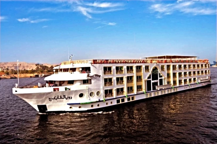
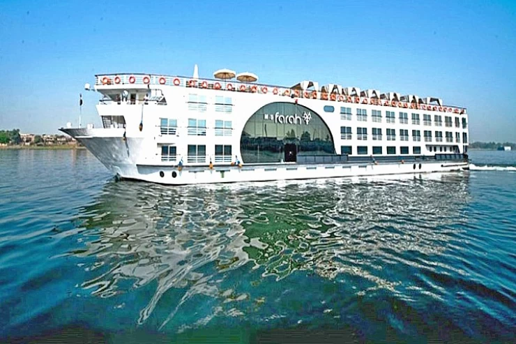
The Nile is still an integral aspect of modern-day Egypt. The river is still used for irrigation and even provides drinking and industrial water. It has also maintained its relevance as a waterway, and especially as a tourism-based route. Cruises on the Nile between Luxor and Aswan allow tourists to experience the beauty of the river and, along the way, some of the exotic historic sites of Egypt. This pace of the river sets the mood for temple, tomb, and village raids, which are fun-beholding sights of historical Egypt.
The Nile has been a major factor in the growth of cities like Cairo, Aswan, and Luxor. In Cairo, the Nile passes through the very middle of the populated city, providing a serene gate away from the noisy road. Corniche El Nile, which is a wall fronting the river in the city, is frequented by people, both locals and tourists, who go there to see the river, and particularly sunsets are breathtaking. Calm sailing wooden boats called feluccas move on top of the river, recalling the magic of the serene Nile.
Aswan is characterized by the majestic flow of the Nile that meanders, surrounded by patches of granite and tiny islands, providing an ideal ambiance to learn about the Nubian culture and Philae Temple. The slower-paced atmosphere created by the clear waters in Aswan makes it one of the most captivating places along the Nile, where visitors feel relaxed as if everything is flowing with the river at a gentle pace.