Deir El Hagar Temple
Naming
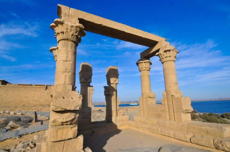
Description of the temple The temple of the stone monastery is one of the most complete Roman ruins in the Dakhla Oasis, despite its relatively small size (its dimensions are 7.3×16.2 m). Olaf Capper from the Dakhla Oasis project stated that the isolated temple, which was usually located in the center of the community, was dedicated more to celebration than worship. The main gate is located on the eastern side of the fence wall, while there is another gate to the south. There are many Greek inscriptions and writings written by the first travelers who wanted to record their visits to this holy place on the wall of the temple courtyard. As travelers began to visit the stone monastery during the 19th century, many of them left their names carved high on the columns and walls of the portico, indicating the level of sand elevation at that time. The members of the Rolfs expedition also engraved their names on one of the pillars in 1874, and in the same year the sand was removed from the sanctuary. Archibald Edmonstone described the temple in 1822, by which time the roof of the complex was still intact and three of the facade columns were still standing. John Gardner Wilkinson drew up a plan of the temple complex in 1825. Herbert Wenlock published the first comprehensive description of the temple in 1908, and during the Sixties, Ahmad Fakhri excavated in front of the portico.
Rolfs' expedition to the stone monastery
The Rolfs expedition began excavations at the site in 1874. Philippe Remillet conducted extensive
excavations on behalf of Gerhard Rolfs, and the excavations have been documented with photographs. The stones raised the roof of the large reinforced sacrificial Hall, two of which were destroyed. The facade of the gate in the Western Wall turned out to be decorative and well preserved, two columns were also uncovered, inside which were found remains of acacia wood and fragments of crowns. The sanctuary of the temple contained inscriptions with astronomical images, and also found remnants of wood and some raw cotton scraps. A boat prop was also found; it can be seen in the photo. This base was rediscovered during restoration work in 1993. Remillet describes that the lower parts of the walls of the structure were black and that the floor was covered with a hard layer resembling "peat". He interpreted this as the remains of pipes from an unknown liquid during recent excavations at the site.
Remillet estimated that the temple was most likely destroyed by earthquakes long after its abandonment, given that the stones of the nodes fell on a high layer of sand. Recent excavations have confirmed this assumption.
Remillet took a set of photographs of the site after the temple was unveiled and published his results in the same year. Rolfs also described the results of the excavations, relying on remillet's report